

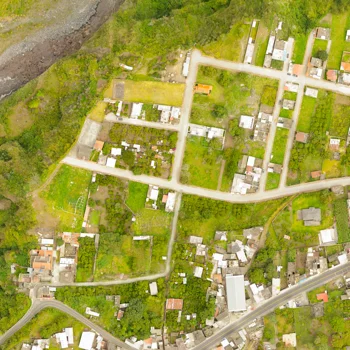
The client is a visual dropbox for current mapping via drones, landscanners, and many other tools. Their resolution allows you to share, use, and manage any modern geospatial 3D documentation in a web browser - and access it throughout the whole project or an asset's life cycle.
The client developed a Software that monitors the progress of construction over time. To improve the accuracy of the Software, They needed to annotate images of construction sites from various months.
In order to increase the accuracy of their Software, the client needed their datasets to be annotated to train the ML algorithms. Such datasets would include images of how construction sites look today and how they looked a couple of months ago. Both of these datasets needed to be annotated so the system could associate them and measure the progress that was made, if any. Since there was a large amount of data that needed to be annotated, the client approached Triyock BPO for assistance.
Triyock assembled a image annotation team of 10 full-time image annotators to label the needed datasets. The client requested that we use QGIS to perform the annotation, which is a free and open- source tool specifically designed for annotating geospatial data. The output needed to be in GeoJSON format which is used for encoding a variety of geographic data structures.
Our experts realise the value of your data and provide you reliability and precision. Talk to our experts now
we create business process that are scalable and adaptable. With our end-to-end outsourcing services, we help you to improve operational agility.

